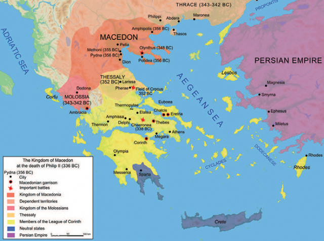
How an atlas and a very old map can help us make sense of the ancient Greeks
Primary History article

The ancient Greeks were a maritime people – they travelled and traded vast distances by sea, but rarely left sight of land. They were also a very divided nation. Separate city states fiercely guarded their independence, only uniting [sometimes!] to fight against a common enemy like the Persians. The Greeks all spoke the same language, lived in very similar ways, yet never united into one country. Can an atlas help us to understand why?
Look carefully at the map. Can you find Athens, Sparta and Thebes? These were the main city-states at the time. What do you notice about them? What do they have in common? Along with most Greek sites, they are all on or near the coast. Why do you think that is? Perhaps another atlas map might help to explain the location of these main Greek sites...
This resource is FREE for Primary HA Members.
Non HA Members can get instant access for £2.49

